Vancouver Housing Price Model
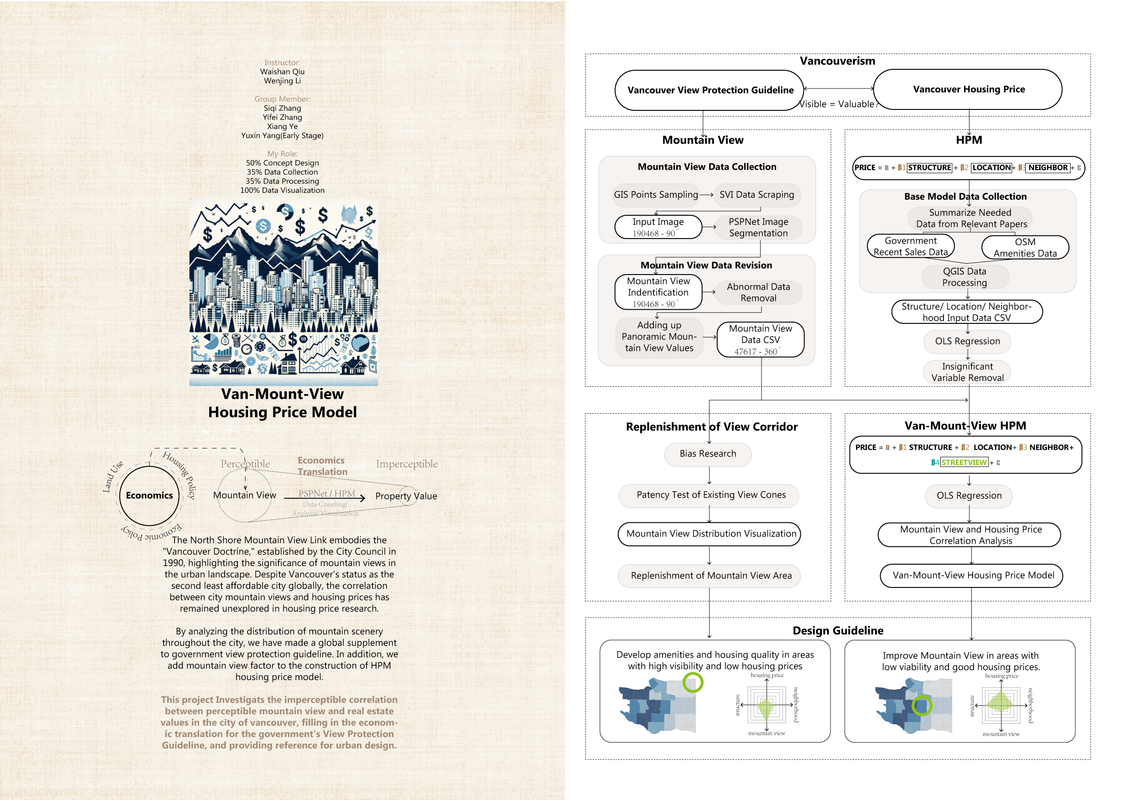
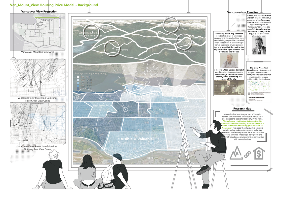
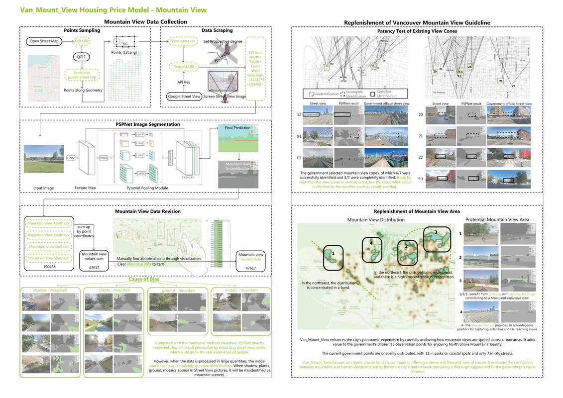
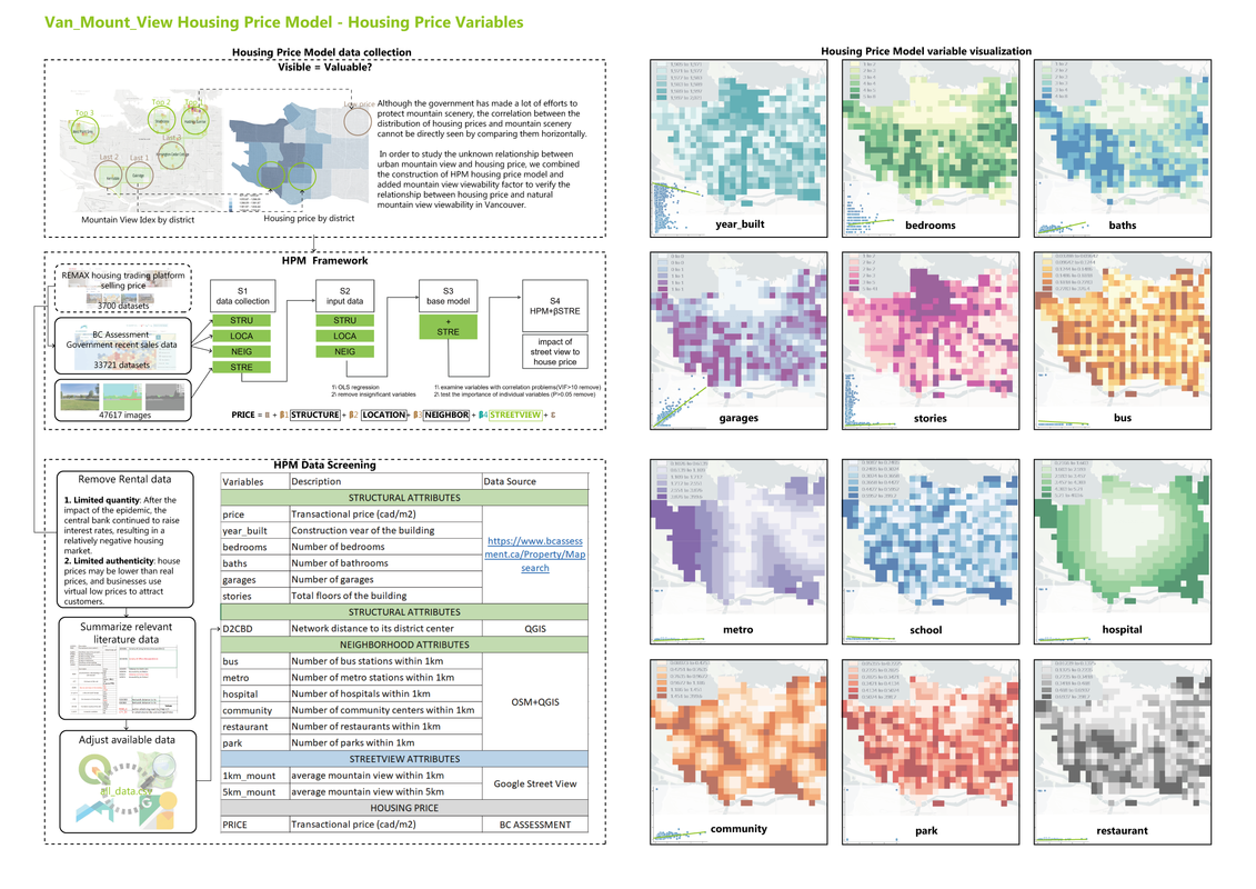
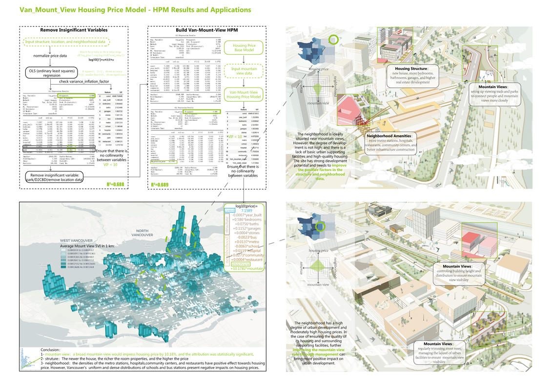
Mountain View Impact combines geospatial visibility analysis with hedonic housing price modeling to quantify how visual access to Vancouver’s North Shore mountains affects property values. By calculating parcel‑level viewshed metrics and embedding them into an HPM framework, the study provides a rigorous, data‑driven supplement to existing government view protection policies.
The workflow uses GIS tools to generate detailed viewshed indices for each lot, which are then joined with transaction records and building attributes. A multivariate hedonic pricing model isolates the premium attributable to mountain views, while interactive map visualizations highlight spatial trends. This integrated method unites environmental aesthetics with urban economics to inform policy and planning decisions.