Color Code
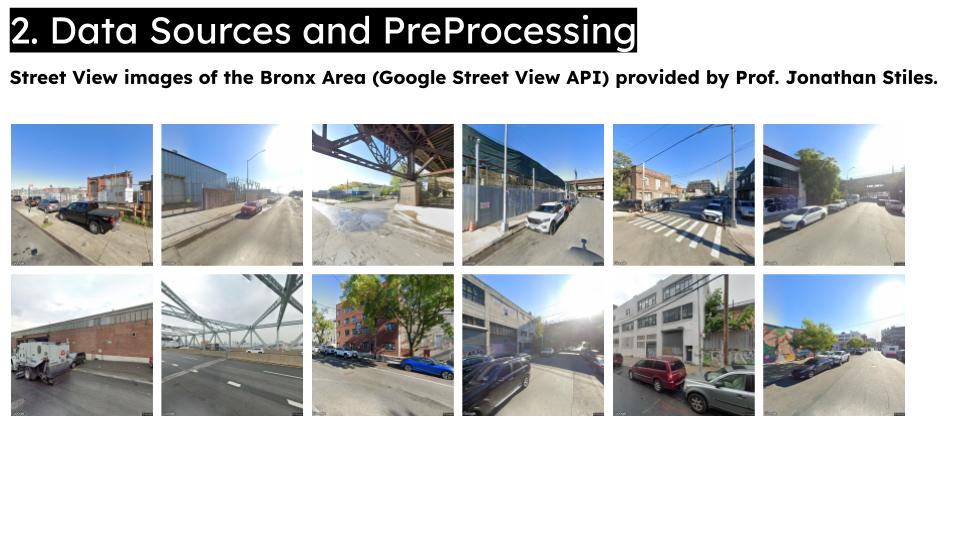
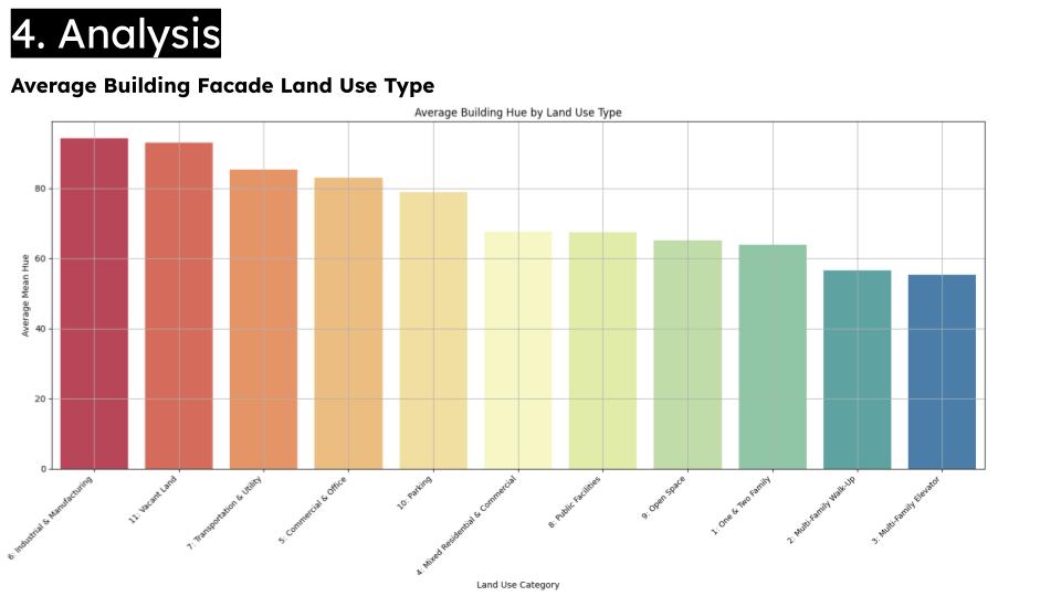
Color Code is a computational pipeline that explores how urban parcel characteristics influence building façade colors in the Bronx. By extracting predominant hues from segmented street‑view images and linking them with property attributes like land use and floor area ratio, the system uncovers spatial patterns in urban color expression and highlights how built environment factors shape visual character.
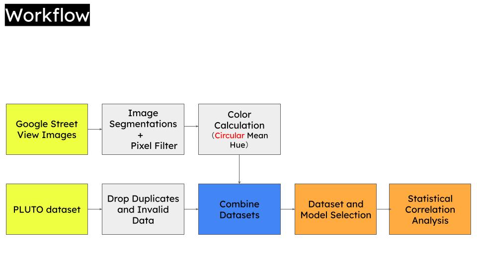
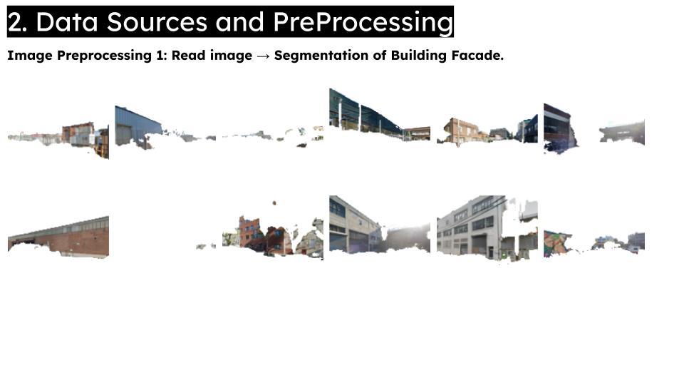
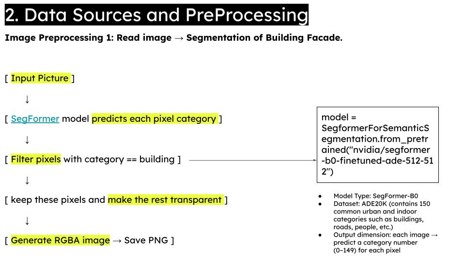
The workflow combines semantic segmentation for façade detection, image processing for hue extraction, and geospatial joins with PLUTO parcel data. Supervised machine learning methods—including logistic regression, random forest, and K‑nearest neighbors—are applied to model the relationship between color and parcel attributes. Interactive choropleth maps and statistical analyses then reveal broader urban aesthetic trends, providing a data‑driven foundation for spatially informed design.